FIRST MADP PUBLICATION!
Our first research paper, “Edmontosaurus from the Rocky Mountain foothills, Alberta, and its chronostratigraphic position in the Late Cretaceous Brazeau Formation and correlative units in western Canada,” has now been published in the Canadian Journal of Earth Sciences! This work discusses two partial Edmontosaurus postorbitals from a site near Hinton, Alberta. They are the youngest confirmed Edmontosaurus bones from Alberta, originating from a time (~71 mya) when the taxon was believed to have been extirpated from the province as the Bearpaw Formation receded. Not only did we provide the first description of vertebrate fossils from the Brazeau Formation, but we also described the first footprints from the formation! Read the paper below!
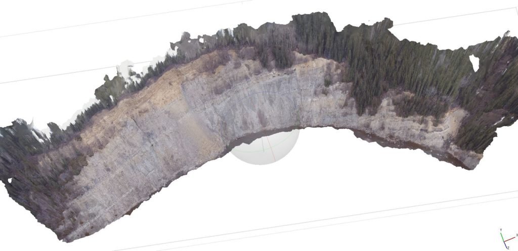
GREAT NEWS! A NEW SUPPORT PARTNER!! (2020)
Excellent news come though the pipes a couple days ago! We have been able to add another corporate supporter to our growing list. In addition to Arc’teryx, Westbound Campgrounds, and the Dinosaur Research Institute, we are proud to announce that Agisoft is supporting MADP by providing us with Metashape Professional photogrammetric software! With Metashape, we will be able to accurately map dig sites using photogrammetry. This will allow us to create highly accurae three dimensional models that can be manipulated in virtual systems, or even printed at scale using 3D printers for display purposes. Additionally, we will now be able to recreate mountain river valleys to more accurately study areas that are hard to access and correlate stratigraphy through bends in the river.
Stay tuned for tutorial videos on how to use Metashape for various types of projects.