
The Brazeau Formation was deposited in a primarily upland environment as sediment eroding from the Main Ranges of the Rocky Mountains was carried east by river. The formation overlies the marine shales of the Wapiabi Formation (equivalent to the Lea Park, Pakowki, and Puskwaskau formations) with an erosional contact. Based on comparisons with other formations, the estimated age of the formation is 80-66.7 MA, making it equivalent to the (from oldest to youngest) Foremost, Oldman, Dinosaur Park, Bearpaw, Horseshoe Canyon, and Battle formations of the Alberta prairies. These formations are visible as exposed rock in Dinosaur Provincial Park, and in the Drumheller region near the Royal Tyrrell Museum, and were home to some of Alberta’s most famous dinosaurs.
Additionally, the Brazeau is equivalent to the Wapiti Formation in the Peace Region of northern Alberta and British Columbia. Fossils from this region can be seen at the Philip J. Currie Dinosaur Museum, near Wembley, Alberta. The Brazeau is overlain by the latest Cretaceous Coalspur Formation throughout the central Alberta foothills.
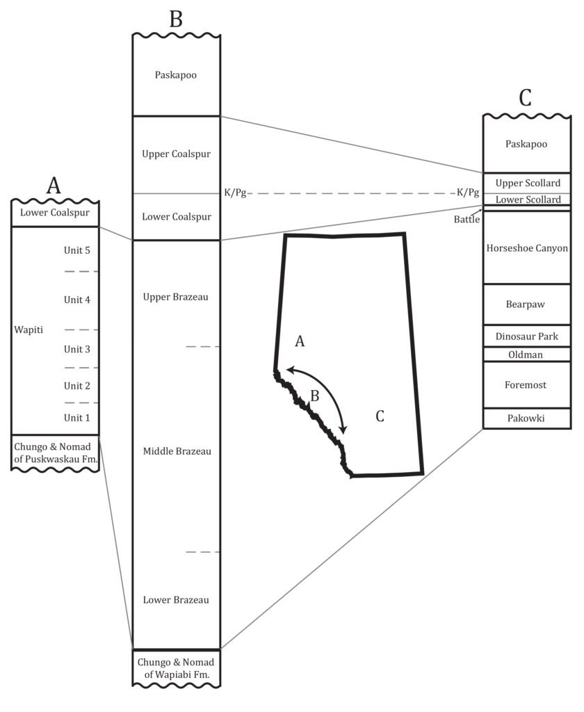
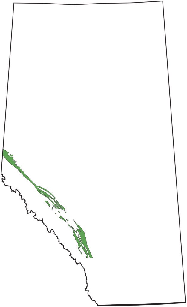
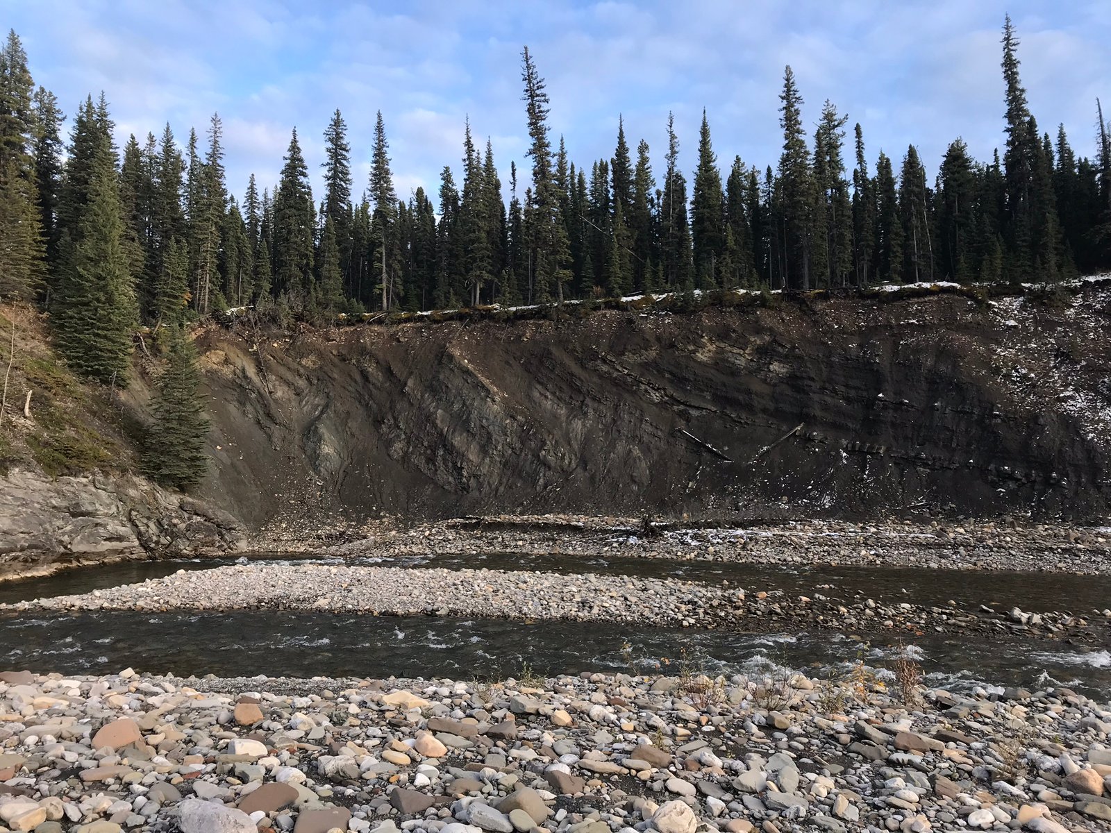
The limited exposure of the Brazeau Formation is primarily restricted to small river outcrops within the Alberta Cordilleran deformation belt stretching nearly 500 km from northwest of Grande Cache to west of Calgary. The formation sediments are heavily cemented, allowing both mudstones and sandstones to be cliff forming. It is these cliff faces that MADP is targeting for our research. The heavily cemented sediments of the Brazeau Formation are both a benefit and a significant hindrance; had these sediments not been heavily cemented, they would have been eroded away by glaciers and the elements. Unfortunately, due to the hardness of the rock, it makes collection and preparation of vertebrate remains extremely difficult.
Currently, the focus of our fieldwork lies in the Hinton, Nordegg, and Sundre. These regions were chosen on three criteria:
- The northern areas tend to preserve the upper portions of the formation, and more of the lower Brazeau is preserved in the southern area.
- Several rivers in each region have enough exposure to make fieldwork viable.
- The geology in these regions is well mapped, and structural features such as faults and folds are also well understood and mapped.
One of the most important aspects of the Brazeau Formation is that it represents a terrestrial depositional environment through the entire thickness. Because of this, we have the opportunity to begin understanding terrestrial palaeofauna during the time of the maximum flooding of the Western Interior Seaway of the late Campanian which formed the Bearpaw Formation. While the lowland formations to the east are where dinosaurs like Albertosaurus, Parasaurolophus, Ornithomimus, and Dromaeosaurus are found, it is unknown if the Brazeau formation preserves these dinosaurs, or instead counterparts more suited to the mountains. Hopefully more fieldwork will help us answer this question.