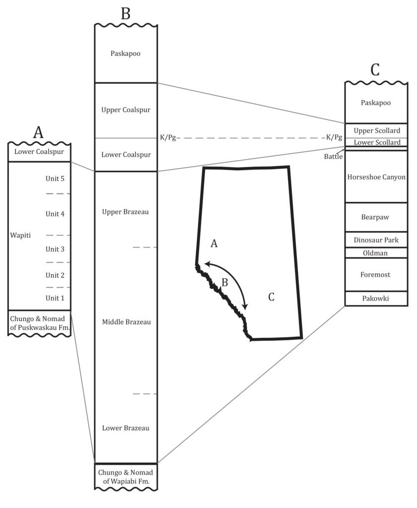
The Coalspur Formation was deposited during the end of the age of dinosaurs (the Mesozoic), and the beginning of the age of mammals (the Cenozoic). It is the western equivalent to the Scollard Formation that is exposed on the Alberta prairies. The lower ~160 meters of the formation represent the last 700 000 years of the Cretaceous. Unfortunately, no vertebrate remains have ever been recovered from the Lower Coalspur, despite several mammal sites being known from the Upper Coalspur Formation.
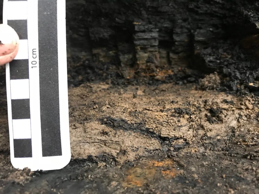
A 15 meter thick conglomerate in the Hinton region, known as the Entrance conglomerate, forms base of Lower Coalspur Formation. This conglomerate spans about 150 km along the Rocky Mountain front. The rest of the Lower Coalspur is composed of primarily multistory thick sandstone channel deposits. The total thickness of the Lower Coalspur reaches approximately 160 m on average, and is separated by the Upper Coalspur by the K/Pg (end-Cretaceous extinction) boundary, of which several boundary clay localities are known in the foothills. This boundary clay is located within the Mynheer Coal, the first major coal seam in the formation, and is on average 4-5 cm thick.